In recent years, San Francisco’s Great Highway has been the site of great drama, both manmade and natural. More is on the horizon.
In November, the city will decide for a third time whether cars should have access to the stretch of the road now known as Sunset Dunes Park. Sometime around Election Day, the city’s rainy season should begin, and forecasters say there’s a good chance for heavy storms — the same kind that in past years battered the shore and ripped out chunks of the Great Highway.
That afflicted section of the road, known as the Great Highway Extension, is less than a mile long and the only barrier that keeps the Pacific Ocean from swamping critical water infrastructure, including a sewage treatment plant, and the San Francisco Zoo.
Part of the extension has already fallen into the ocean, thanks to vicious storms in the winter of 2009-10. The roadway is so narrow that only northbound traffic is allowed now. This stretch of SF’s southwest shore is the city’s first big test to reinforce itself against the rising sea levels and stronger storms of climate change. So far, the city is failing.

A major overhaul should be underway. To combat erosion and a potential breach of the wastewater system, the plan is to close the extension, build a robust seawall, and transform the area into a big sand dune with native plants and a pedestrian and bike path.
But this summer, the San Francisco Public Utilities Commission, the city’s water provider and the lead agency on the project, quietly posted on its website that the start was pushed back to late 2029.
This isn’t the first delay, either. If, as now planned, the project isn’t finished until 2033, it will mark more than two decades since San Francisco took a first big step toward protecting this part of its shore.

Meanwhile, a major El Niño event is brewing in the Pacific, and climate scientists anticipate higher tides than in previous winters. Local tides have already reached more than six inches higher than originally forecasted.
All this will more than likely add up to abnormally high waves crashing on to Ocean Beach, and more erosion eating away at the beach and bluffs.
The coast won’t wait for the city to move from plans to action. The shore has long had its own agenda.
An engineered shoreline
San Francisco has had to manage erosion at Ocean Beach ever since it developed its western neighborhoods more than a century ago.
After leveling the sand dunes that once met the Pacific, the city pushed the shoreline 200 feet seaward and built a concrete wall to separate the beach from development. Erosion soon began to take its toll, particularly at the southern end, and the city started hauling in sand to replenish the beach, according to a recent study.
Déjà vu occurred about 100 years later when the city moved a sewage treatment facility two and a half miles south, from Golden Gate Park to the current location next to the zoo along the Great Highway Extension.

Completed in 1993, the work included a wastewater tunnel — basically a big concrete tube — that runs under the Great Highway Extension. (Both run parallel to the shoreline.) By the end of the 1990s, the city once again had to dump sand, sandbags, and riprap along this stretch of Ocean Beach to fight erosion.
After a decade of this frequent ritual, the California Coastal Commission, which regulates use of the state’s coastal land and waters, ordered the city to make a long-term plan.
That plan, a collaboration between state, federal, and local agencies and community groups, came out in 2012. It offered several options.
In 2015, coastal engineers began designing options to protect the wastewater tunnel, which connects to a pump station at the west end of Sloat Boulevard. One concept that emerged was a new concrete seawall covered by a manmade sand dune and native plants.
There were other details to work out, but at that time the Coastal Commission urged the city to “implement” the plan no later than 2021. That deadline came and went.
In 2022, the SFPUC had the final plan in place: not just a wall and sand dune, but a walking and biking trail, as well as the complete removal of the Great Highway Extension. The agency hoped it could start construction in late 2023 or early 2024 and wrap up by the end of 2027.
Now the SFPUC has pushed back the start date another five-plus years to the end of 2029. The entire project (formally the Ocean Beach Climate Change Resilience Project) won’t be done until 2033, at the earliest.

SFPUC spokeswoman Nancy Crowley says the latest delay is due to three factors. One is that the Coastal Commission requested several design changes. Crowley says the project team is working on seven modifications, including the relocation of beach-access stairs and the redesign of a restroom at the south end of the trail. More changes could happen prior to construction, Crowley adds.
A second reason for the delay is that the SFPUC only recently identified the need for improvements to a pipe — separate from the concrete wastewater tunnel — in the same area. “Doing that work as part of this project will avoid having to return later and disrupt the area again,” Crowley says.

The third reason is zoo access. Right now, cars going northbound on the Great Highway Extension can enter and exit the zoo parking lot. Closing the extension for good means shifting all traffic to the Sloat Boulevard access point, which is currently designed only for entrances.
The Board of Supervisors voted to permanently close the extension in May 2024, more than two years ago. Crowley says the original design for zoo access assumed that the Upper Great Highway would be open to cars on weekdays. But Prop K’s victory in Nov. 2024 turned that road into Sunset Dunes Park, which planners must adjust for.
A controversial solution
At the core of the work to keep the Pacific from eating more of the shoreline is a 3,200-foot-long concrete seawall buried under sand. When the work’s done, you won’t be able to see it.
But opponents are well aware of it. They point out that seawalls can contribute to beach erosion long-term, and the California Coastal Act of 1976, which created the Coastal Commission, restricts their use.
The act makes some exceptions to protect existing structures or when public beaches are in danger of short-term erosion. While Ocean Beach falls into the latter category, the tunnel and sewage treatment plant are not “existing structures” because they were built after the Coastal Act took effect.
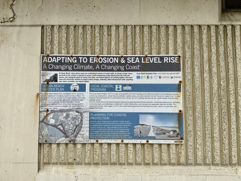
This conflict led the Coastal Commission to call for compromise. Members voiced concerns about the wall but felt it was the best option available. They required the seawall and other “armoring” to be as limited as possible and to enhance public access to the beach. They also noted that the city would have to keep dumping sand on the beach every so often, like it has done for years, an admission that the wall and dune won’t combat erosion completely.
Once the wall is in place, the commission will require San Francisco to measure its effect on erosion and report every year for five years. At the five-year mark, the commission will assess next steps.
Chase Davenport, founder of the Ocean Beach Institute and lead author of the recent Ocean Beach study, is uneasy about the seawall. But he’s sympathetic to the SFPUC’s plight. “None of the people who currently work there made the decision to put critical infrastructure in such a threatening position,” he says, referring to the sewage plant’s move from Golden Gate Park more than 30 years ago.

Davenport suggests that the city should eventually move the concrete wastewater tunnel away from the shore. He noted that the city of Santa Cruz has voted to move West Cliff Drive, a significant coastal road, to protect drivers and the road from flooding and erosion that have caused past closures.
Davenport also warns that SF’s current sand source won’t be enough and recommends finding more sources.
Meanwhile, all that’s protecting the southern end of Ocean Beach right now are sandbags and riprap, and El Niño is coming. SFPUC’s Crowley says the agency “continues to monitor conditions” and that the city will work with the Coastal Commission to take appropriate action, such as emergency replenishment of protective materials “if conditions become unsafe or certain triggers are met.”
San Francisco also has another political storm to navigate.
Add G to I, J, and K
For the third time in a four-year stretch, SF voters will weigh in on the Upper Great Highway. November’s ballot includes Prop G, which would reopen the road to cars on weekdays and close it on weekends and federal holidays — a return to the compromise in effect between 2022 and 2025.
However the vote turns out, it won’t affect the closure of the Great Highway Extension, which has been destined for destruction for years, first by Mother Nature, then by City Hall.

Some San Franciscans tried to keep it open in 2022. That year, as part of the backlash against COVID street closures, some of the folks behind this year’s Prop G authored a measure to reopen JFK Drive to cars, end the weekday-weekend compromise on the Upper Great Highway, and force the Great Highway Extension to stay open. It lost handily, with 65 percent opposed. A rival measure to keep JFK Drive car-free won by nearly the same split.

In 2024, the Sunset District’s supervisor Joel Engardio championed Prop K, a full closure of the Upper Great Highway, turning it into Sunset Dunes Park. That won too, but by a slimmer margin, and the western neighborhoods turned their anger into a successful recall of Engardio less than a year later. Now they’re hoping citywide voters will reverse their Prop K vote, and they’ve consistently used misinformation about local traffic data to push their point.

Even if Prop G backers defy the odds and get cars back on the Upper Great Highway, traffic patterns in the city’s southwest corner will have to change. The end of the extension also blocks a short cut between the beach and Daly City. In fact, that inconvenience has been partially in place for more than a year, what with the Extension’s southbound lanes already shut down.
Just like billions of other people on the planet dealing with climate change, drivers on San Francisco’s west side will just keep having to adapt. And if plans, delayed again, to reinforce the water and sewage system there aren’t adequate, San Francisco will have even more urgent adaptation to deal with.